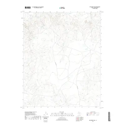
2019 Map of Big George Tank
USGS Topo · Published 2019About this map
George Canyon and the surrounding drainage network define this portion of the Texas Panhandle, where water management is central to the land's utility. Named water features like Big George Tank and George Spring Tank illustrate the localized efforts to capture and store surface water in a landscape carved by seasonal waterways. The terrain is marked by numerous natural springs, including Joaquin Springs, Rock Springs, and Cheyenne Spring, which have likely served as vital landmarks for generations. The presence of E Main Ranch Rd indicates the ongoing ranching legacy in this region of Oldham County. This survey provides a clear view of the complex hydrography, from the headwaters of Las Arches Cr to the southeastern reaches of Bluff Cr, revealing how topography and water sources dictate the placement of local infrastructure.
Find a feature on this map
15 named features on this map. Tap any name to fly to it.
Don’t see what you’re looking for? This feature index may not catch every label — zoom into the map to look around manually.
Map Details
Editions of this 2019 Big George Tank Map
This is the sole edition of this map. No revisions or reprints were ever made.
Other maps of this area

1954 · Tucumcari
USGS Topo · 1:250,000

1958 · Tucumcari
USGS Topo · 1:250,000

1966 · Alamocitos Camp
USGS Topo · 1:24,000

1966 · Adrian
USGS Topo · 1:24,000

1966 · Signal Spring SE
USGS Topo · 1:24,000

1966 · Big George Tank
USGS Topo · 1:24,000

1966 · Landergin
USGS Topo · 1:24,000

1966 · Vat Camp
USGS Topo · 1:24,000

1971 · Romero SE
USGS Topo · 1:24,000

1971 · Many Post Camp
USGS Topo · 1:24,000