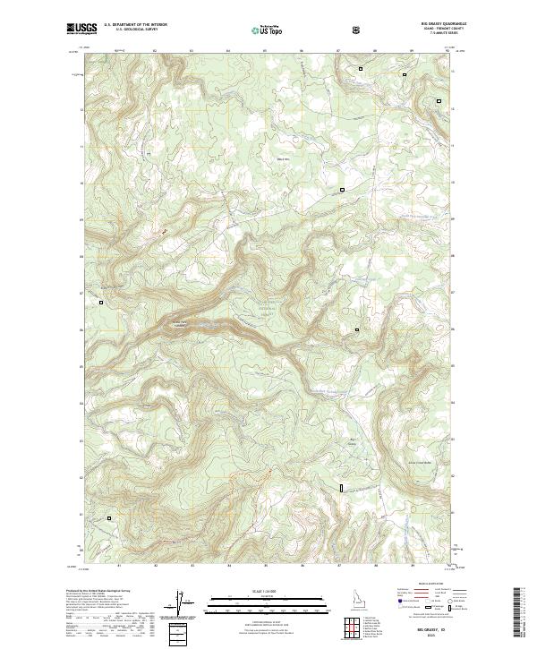
2023 Map of Big Grassy
USGS Topo · Published 2023About this map
Targhee National Forest dominates this section of eastern Idaho, showcasing a landscape defined by the ancient geology of the Island Park Caldera. This 2023 survey illustrates an intricate drainage system feeding into the Warm River and North Fork Fish Creek, alongside prominent local elevations like Black Mtn and Snow Creek Butte. The map reveals a specialized network of forest infrastructure, featuring numerous timber-related routes such as Long Haul Rd and Log Haul 4 Spur 2, which indicate the area's ongoing importance for resource management. High-altitude meadows and ridges, including the namesake Big Grassy area, are accessible via a complex of specialized paths like Flat Canyon Trl and Trail Canyon, reflecting the dual use of these public lands for both industry and backcountry navigation.
Find a feature on this map
37 named features on this map. Tap any name to fly to it.
Don’t see what you’re looking for? This feature index may not catch every label — zoom into the map to look around manually.
Map Details
Editions of this 2023 Big Grassy Map
This is the sole edition of this map. No revisions or reprints were ever made.
Other maps of this area

1955 · Ashton
USGS Topo · 1:250,000

1957 · Warm River Butte
USGS Topo · 1:62,500

1957 · Buffalo Lake
USGS Topo · 1:62,500

1958 · Ashton
USGS Topo · 1:250,000

1960 · Ashton
USGS Topo · 1:250,000

1964 · Hatchery Butte
USGS Topo · 1:24,000

1964 · Island Park
USGS Topo · 1:24,000

1965 · Snake River Butte
USGS Topo · 1:24,000
1986 · Latham Spring
USGS Topo · 1:24,000
1986 · Buffalo Lake NE
USGS Topo · 1:24,000