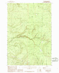
1986 Map of Big Grassy
USGS Topo · Published 1986About this map
Targhee National Forest dominates this mid-1980s terrain, providing a look at the drainage systems and peaks of Fremont County. The landscape is defined by the high point at Black Mountain and the prominent Big Grassy plateau. Waterways carve through the forest in every direction, from the larger South Fork and North Fork to smaller tributaries like Partridge Creek, Split Creek, and Snow Creek.
Find a feature on this map
17 named features on this map. Tap any name to fly to it.
Don’t see what you’re looking for? This feature index may not catch every label — zoom into the map to look around manually.
Map Details
Editions of this 1986 Big Grassy Map
This is the sole edition of this map. No revisions or reprints were ever made.
Other maps of this area

1955 · Ashton
USGS Topo · 1:250,000

1957 · Warm River Butte
USGS Topo · 1:62,500

1957 · Buffalo Lake
USGS Topo · 1:62,500

1958 · Ashton
USGS Topo · 1:250,000

1960 · Ashton
USGS Topo · 1:250,000

1964 · Hatchery Butte
USGS Topo · 1:24,000

1964 · Island Park
USGS Topo · 1:24,000

1965 · Snake River Butte
USGS Topo · 1:24,000
1986 · Latham Spring
USGS Topo · 1:24,000
1986 · Buffalo Lake NE
USGS Topo · 1:24,000