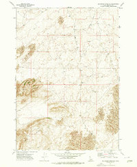
1972 Map of Big Grassy Ridge SE
USGS Topo · Published 1976About this map
North Junipers and South Junipers dominate the topography of this Fremont County landscape, revealing an environment shaped by volcanic activity and shifting sands. Located north of St. Anthony, the region is defined by extensive Sand Dunes and localized volcanic features like the Cinder Pits, which indicate the area's geological origins. The limited infrastructure of the early 1970s is represented by a network of unimproved routes, most notably the Red Road and the appropriately named Crooked Road. These corridors provided essential access through the high desert terrain for ranching or resource extraction. The presence of several Well sites across the quadrangle highlights the critical importance of water management in this arid Idaho backcountry.
Find a feature on this map
7 named features on this map. Tap any name to fly to it.
Don’t see what you’re looking for? This feature index may not catch every label — zoom into the map to look around manually.
Map Details
Editions of this 1972 Big Grassy Ridge SE Map
This is the sole edition of this map. No revisions or reprints were ever made.
Other maps of this area

1948 · Parker
USGS Topo · 1:24,000

1950 · Parker
USGS Topo · 1:24,000

1950 · St Anthony
USGS Topo · 1:24,000

1951 · Plano
USGS Topo · 1:24,000

1955 · Ashton
USGS Topo · 1:250,000

1955 · Driggs
USGS Topo · 1:250,000

1958 · Driggs
USGS Topo · 1:250,000

1958 · Ashton
USGS Topo · 1:250,000

1960 · Ashton
USGS Topo · 1:250,000

1962 · Driggs
USGS Topo · 1:250,000