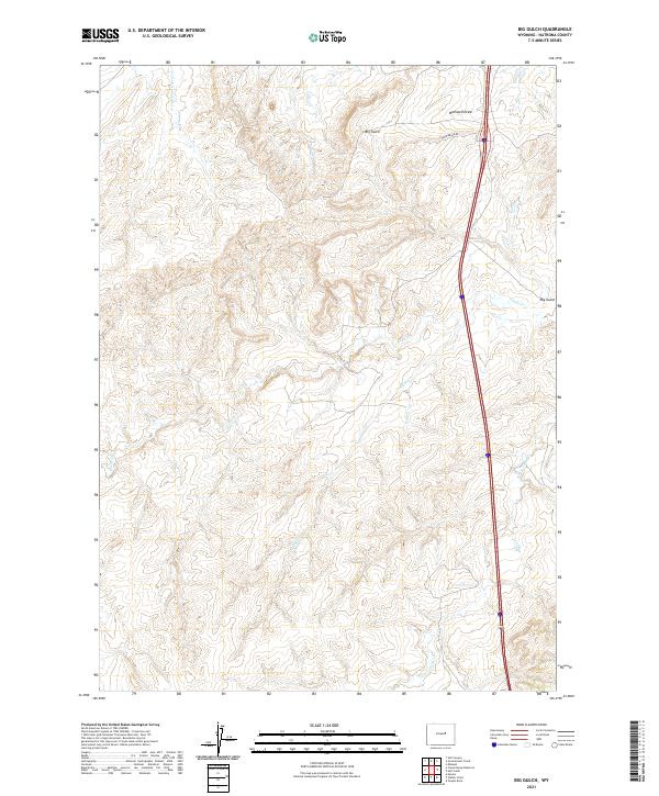
2021 Map of Big Gulch
USGS Topo · Published 2021About this map
Bothwell Draw and the namesake Big Gulch define the drainage patterns of this high-plains landscape in Natrona County. The modern transportation corridor of I-25 and Us-87 slices through the eastern sections, running parallel to the older local route of Shepperson Rd in the north. This 2021 survey by the U.S. Geological Survey illustrates a sparsely populated ranching and energy landscape where water management is critical, evidenced by the intricate networks of Castle Cr and the N Fork Dead Horse Cr. The topography is marked by a series of draws and alkaline creek beds like Alkali Cr, showcasing the transition from traditional grazing lands to the infrastructure required for interstate commerce in the Wyoming interior.
Find a feature on this map
15 named features on this map. Tap any name to fly to it.
Don’t see what you’re looking for? This feature index may not catch every label — zoom into the map to look around manually.
Map Details
Editions of this 2021 Big Gulch Map
This is the sole edition of this map. No revisions or reprints were ever made.
Other maps of this area

1955 · Arminto
USGS Topo · 1:250,000

1958 · Arminto
USGS Topo · 1:250,000

1962 · Arminto
USGS Topo · 1:250,000

1968 · Big Gulch
USGS Topo · 1:24,000

1968 · Merino
USGS Topo · 1:24,000

1968 · Midwest
USGS Topo · 1:24,000

1968 · Salt Creek
USGS Topo · 1:24,000
1968 · Statzer Point
USGS Topo · 1:24,000
1968 · Teapot Rock
USGS Topo · 1:24,000

1968 · Camel Hump Reservoir
USGS Topo · 1:24,000