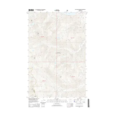
2014 Map of Big Hawk Mountain
USGS Topo · Published 2014About this map
Flathead National Forest defines this high-elevation landscape within the Swan Range of Montana. The area is marked by a complex network of glacial basins and alpine summits, including Mt Orvis Evans and Big Hawk Mtn. Water distribution is characterized by numerous small mountain lakes like Margaret Lake, Tom Tom Lake, and the Three Eagles Lakes, which feed a drainage system of creeks such as Wheeler Cr and Quintonkon Cr. The northern edge of the map reaches Graves Bay, providing a point of transition between the high peaks and the valley below. Human presence is sparse, limited primarily to W Side Rd in the north and the surveying boundaries of the Lake County and Flathead County line. This 2014 survey serves as a detailed record of the drainage patterns and peaks like Wickijup Mtn before further shifts in the regional hydrology.
Find a feature on this map
41 named features on this map. Tap any name to fly to it.
Don’t see what you’re looking for? This feature index may not catch every label — zoom into the map to look around manually.
Map Details
Editions of this 2014 Big Hawk Mountain Map
This is the sole edition of this map. No revisions or reprints were ever made.
Other maps of this area

1914 · Nyack
USGS Topo · 1:125,000

1955 · Choteau
USGS Topo · 1:250,000

1957 · Choteau
USGS Topo · 1:250,000

1958 · Choteau
USGS Topo · 1:250,000

1958 · Quintonkon
USGS Topo · 1:24,000

1958 · Felix Peak
USGS Topo · 1:24,000

1960 · Cut Bank
USGS Topo · 1:250,000

1962 · Choteau
USGS Topo · 1:250,000

1963 · Cut Bank
USGS Topo · 1:250,000

1964 · Cut Bank
USGS Topo · 1:250,000