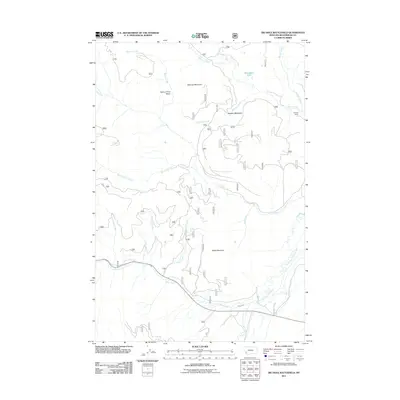
2011 Map of Big Hole Battlefield
USGS Topo · Published 2011About this map
Maybee Ranch and Maybee Meadows occupy the northeastern slopes of this high-elevation landscape within Beaverhead County. The terrain is defined by the sharp rise of Wooster Mountain and the prominent Battle Mountain, where the drainages of Salix Creek and Placer Creek converge toward the larger valley floor. This 2011 survey documents a complex network of forest service roads and trails that navigate the high basins and creek beds.
Find a feature on this map
48 named features on this map. Tap any name to fly to it.
Don’t see what you’re looking for? This feature index may not catch every label — zoom into the map to look around manually.
Map Details
Editions of this 2011 Big Hole Battlefield Map
This is the sole edition of this map. No revisions or reprints were ever made.
Other maps of this area

1955 · Dillon
USGS Topo · 1:250,000

1957 · Dillon
USGS Topo · 1:250,000

1958 · Dillon
USGS Topo · 1:250,000

1962 · Dillon
USGS Topo · 1:250,000

1965 · Dillon
USGS Topo · 1:250,000

1966 · Gibbons School
USGS Topo · 1:24,000

1966 · Big Hole Battlefield
USGS Topo · 1:24,000

1966 · Big Hole Pass
USGS Topo · 1:24,000
1966 · Elk Creek
USGS Topo · 1:24,000
1966 · Highland Ranch
USGS Topo · 1:24,000