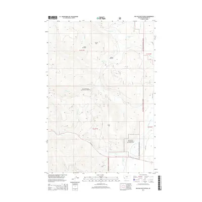
2014 Map of Big Hole Battlefield
USGS Topo · Published 2014About this map
Big Hole National Battlefield occupies the southeastern portion of this terrain, marking the site of the 1877 conflict along the N Fork Big Hole River. The landscape is dominated by the high elevations of the Beaverhead National Forest, where prominent peaks like Battle Mtn and Wooster Mtn overlook a complex network of alpine drainages. The map reveals a transition from the wooded slopes of the forest to the open spaces of Maybee Meadows. Transportation through this high country is primarily defined by State Hwy 43, which follows the path of Trail Cr as it winds through the valley. Local hydrology is intricate, featuring high-altitude water bodies such as Nymphaea Lake and the marshy grounds of the Beaver Pond Basin.
Find a feature on this map
26 named features on this map. Tap any name to fly to it.
Don’t see what you’re looking for? This feature index may not catch every label — zoom into the map to look around manually.
Map Details
Editions of this 2014 Big Hole Battlefield Map
This is the sole edition of this map. No revisions or reprints were ever made.
Other maps of this area

1955 · Dillon
USGS Topo · 1:250,000

1957 · Dillon
USGS Topo · 1:250,000

1958 · Dillon
USGS Topo · 1:250,000

1962 · Dillon
USGS Topo · 1:250,000

1965 · Dillon
USGS Topo · 1:250,000

1966 · Gibbons School
USGS Topo · 1:24,000

1966 · Big Hole Battlefield
USGS Topo · 1:24,000

1966 · Big Hole Pass
USGS Topo · 1:24,000
1966 · Elk Creek
USGS Topo · 1:24,000
1966 · Highland Ranch
USGS Topo · 1:24,000