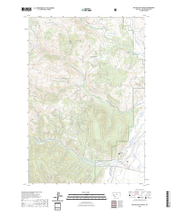
2024 Map of Big Hole Battlefield
USGS Topo · Published 2024About this map
Big Hole National Battlefield anchors the southeastern corner of this modern topographic study, preserving the site of the 1877 conflict between the U.S. Army and the Nez Perce. The landscape is defined by the North Fork Big Hole River and its numerous tributaries, including Trail Creek and Salix Creek, which wind through the drainage basins of the Beaverhead National Forest. High points such as Battle Mtn and Wooster Mtn overlook a series of high-altitude clearings like Maybee Meadows and Beaver Pond Basin. The map also identifies historical markers and access points including the Battlefield Cem and the Nez Perce Camp Trl, which provide essential context for researchers tracing the geography of the Nez Perce War within the larger Anaconda Range landscape.
Find a feature on this map
34 named features on this map. Tap any name to fly to it.
Don’t see what you’re looking for? This feature index may not catch every label — zoom into the map to look around manually.
Map Details
Editions of this 2024 Big Hole Battlefield Map
This is the sole edition of this map. No revisions or reprints were ever made.
Other maps of this area

1955 · Dillon
USGS Topo · 1:250,000

1957 · Dillon
USGS Topo · 1:250,000

1958 · Dillon
USGS Topo · 1:250,000

1962 · Dillon
USGS Topo · 1:250,000

1965 · Dillon
USGS Topo · 1:250,000

1966 · Gibbons School
USGS Topo · 1:24,000

1966 · Big Hole Battlefield
USGS Topo · 1:24,000

1966 · Big Hole Pass
USGS Topo · 1:24,000
1966 · Elk Creek
USGS Topo · 1:24,000
1966 · Highland Ranch
USGS Topo · 1:24,000