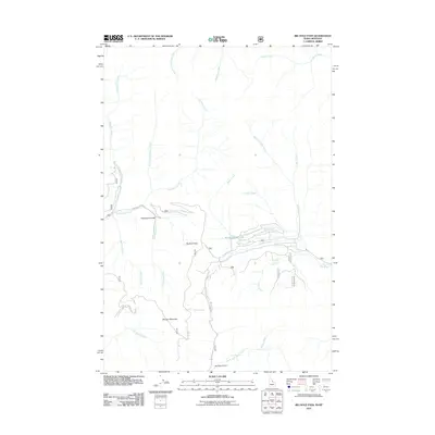
2011 Map of Big Hole Pass
USGS Topo · Published 2011About this map
Big Hole Pass marks a critical divide in this high-altitude landscape of Beaverhead County, where the drainages of the Bitterroot and Pioneer ranges meet. The terrain is defined by a dense network of mountain waterways, including the headwaters of Ruby Creek, Pioneer Creek, and Dahlonega Creek. Significant elevations like Morgan Mountain overlook complex topographical features such as Thompson Gulch and Bradley Gulch.
Find a feature on this map
23 named features on this map. Tap any name to fly to it.
Don’t see what you’re looking for? This feature index may not catch every label — zoom into the map to look around manually.
Map Details
Editions of this 2011 Big Hole Pass Map
This is the sole edition of this map. No revisions or reprints were ever made.
Other maps of this area

1955 · Dillon
USGS Topo · 1:250,000

1957 · Dillon
USGS Topo · 1:250,000

1958 · Dillon
USGS Topo · 1:250,000

1962 · Dillon
USGS Topo · 1:250,000

1965 · Dillon
USGS Topo · 1:250,000

1966 · Lost Trail Pass
USGS Topo · 1:24,000

1966 · Shewag Lake
USGS Topo · 1:24,000

1966 · Big Hole Battlefield
USGS Topo · 1:24,000

1966 · Jumbo Mountain
USGS Topo · 1:24,000

1966 · Big Hole Pass
USGS Topo · 1:24,000