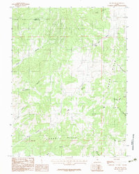
1983 Map of Big Hollow
USGS Topo · Published 1983About this map
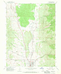
Cedar Hills dominate this high-desert landscape in the early 1980s, marking the transition where the Juab Co and Sanpete Co border crosses through complex drainage systems. The map detail highlights an intricate network of hollows and washes that define the area's hydrology and land use. Notable water sources such as Whitaker Springs, House Spring, and Cottonwood Spring appear as critical landmarks for range management and wildlife within this arid terrain.
Find a feature on this map
17 named features on this map. Tap any name to fly to it.
Don’t see what you’re looking for? This feature index may not catch every label — zoom into the map to look around manually.
Map Details
Editions of this 1983 Big Hollow Map
2 editions found
Other maps of this area

1885 · Manti
USGS Topo · 1:250,000

1895 · Manti
USGS Topo · 1:250,000

1951 · Moroni
USGS Topo · 1:62,500

1952 · Santaquin Peak
USGS Topo · 1:62,500

1956 · Price
USGS Topo · 1:250,000

1960 · Price
USGS Topo · 1:250,000

1962 · Price
USGS Topo · 1:250,000
1967 · Indianola
USGS Topo · 1:24,000
1967 · Mount Pleasant
USGS Topo · 1:24,000
1967 · Fairview
USGS Topo · 1:24,000