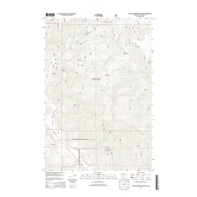
2014 Map of Big Huckleberry Mountain
USGS Topo · Published 2014About this map
Gifford Pinchot National Forest dominates this section of the Cascade Range, defined by its complex network of drainage basins and high-elevation peaks. The landscape is oriented around Big Huckleberry Mtn and Gobblers Knob, with the Pacific Crest National Scenic Trail winding through the central high country. In the south, the settlement of Carson sits near the confluence of the Wind River and Little Wind River, serving as a gateway to the timberlands and recreation areas.
Find a feature on this map
37 named features on this map. Tap any name to fly to it.
Don’t see what you’re looking for? This feature index may not catch every label — zoom into the map to look around manually.
Map Details
Editions of this 2014 Big Huckleberry Mountain Map
This is the sole edition of this map. No revisions or reprints were ever made.
Other maps of this area

1926 · Hood River
USGS Topo · 1:125,000

1929 · Hood River
USGS Topo · 1:125,000

1953 · The Dalles
USGS Topo · 1:250,000

1956 · The Dalles
USGS Topo · 1:250,000

1957 · The Dalles
USGS Topo · 1:250,000

1957 · Bonneville Dam
USGS Topo · 1:62,500

1957 · Wind River
USGS Topo · 1:62,500

1957 · Willard
USGS Topo · 1:62,500

1957 · Hood River
USGS Topo · 1:62,500
1979 · Bonneville Dam
USGS Topo · 1:24,000