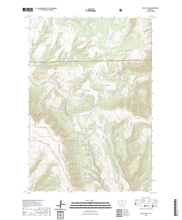
2024 Map of Big Ice Cave
USGS Topo · Published 2024About this map
Custer National Forest encompasses the rugged highlands of Carbon and Big Horn Counties, where the Pryor Mountains rise above a landscape defined by deep drainages and limestone plateaus. This recent topographic record illustrates the intricate network of primitive routes and specialized trails that provide access to the high country, including the Shriver Peak Road Trl and the Crater Ice Cave Trl. The map details a wilderness environment punctuated by isolated water sources such as Trappers Cabin Spring and Teples Spring, which are essential landmarks in this arid upland. High-altitude features like Big Pryor Mtn and Shriver Peak overlook complex geological formations such as Tibbs Hollow and Mill Hollow, reflecting the area's value for resource management and backcountry recreation.
Find a feature on this map
59 named features on this map. Tap any name to fly to it.
Don’t see what you’re looking for? This feature index may not catch every label — zoom into the map to look around manually.
Map Details
Editions of this 2024 Big Ice Cave Map
This is the sole edition of this map. No revisions or reprints were ever made.
Other maps of this area

1954 · Billings
USGS Topo · 1:250,000

1957 · Billings
USGS Topo · 1:250,000

1958 · Billings
USGS Topo · 1:250,000

1964 · Big Ice Cave
USGS Topo · 1:24,000

1964 · Red Pryor Mountain
USGS Topo · 1:24,000

1964 · East Pryor Mountain
USGS Topo · 1:24,000
1964 · Mystery Cave
USGS Topo · 1:24,000

1967 · Deep Creek SE
USGS Topo · 1:24,000

1967 · Castle Rocks
USGS Topo · 1:24,000

1967 · Deep Creek SW
USGS Topo · 1:24,000