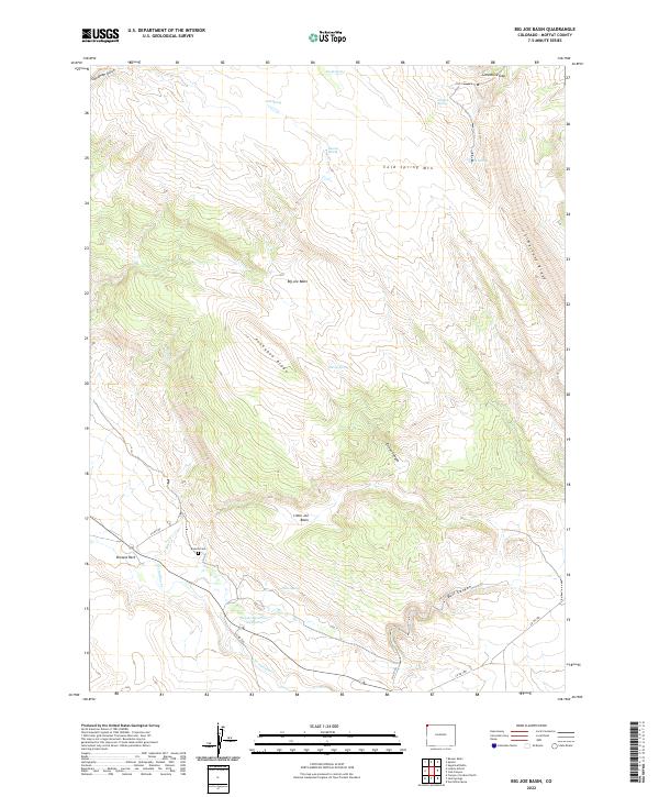
2022 Map of Big Joe Basin
USGS Topo · Published 2022About this map
Browns Park sits in the southwestern corner of this Colorado landscape, where the waters of Matt Cr and Vermillion Cr meet the lowlands. This high-altitude basin environment is defined by its complex drainage systems and isolated landmarks, including the small Bassett Cem and the nearby Basset Reservoir Number 2. These features, along with Pablo Spring, suggest a history of localized water management critical for ranching or survival in the arid terrain.
Find a feature on this map
32 named features on this map. Tap any name to fly to it.
Don’t see what you’re looking for? This feature index may not catch every label — zoom into the map to look around manually.
Map Details
Editions of this 2022 Big Joe Basin Map
This is the sole edition of this map. No revisions or reprints were ever made.
Other maps of this area

1954 · Lodore School
USGS Topo · 1:24,000

1954 · Canyon of Lodore North
USGS Topo · 1:24,000

1954 · Vernal
USGS Topo · 1:250,000

1958 · Vernal
USGS Topo · 1:250,000

1960 · Vernal
USGS Topo · 1:250,000

1966 · Sugarloaf Butte
USGS Topo · 1:24,000
1966 · Beaver Basin
USGS Topo · 1:24,000

1966 · Big Joe Basin
USGS Topo · 1:24,000
1966 · Sparks
USGS Topo · 1:24,000

1966 · Irish Canyon
USGS Topo · 1:24,000