
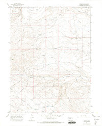
1966 Map of Sugarloaf Butte
USGS Topo · Published 1969About this map
Sugarloaf Butte stands as a prominent landmark in this high-desert landscape along the border of Wyoming and Colorado in the mid-1960s. The terrain is defined by an intricate network of drainages, including the prominent Vermillion Creek and Talamantes Creek, which carve through the arid plateaus of Fonce Flat. This era of land use is characterized by energy exploration, with numerous Oil Wells scattered across the northern sections of the map, particularly near the Wyoming line. Small bodies of water like Fonce Lake and G Lake punctuate the landscape, serving as rare catchments in a region dominated by ephemeral features such as Fonce Wash and Canyon Creek. The map provides a precise record of industrial activity and natural topography at a time when remote oil exploration was shaping the development of the northern Moffat County panhandle.
Find a feature on this map
12 named features on this map. Tap any name to fly to it.
Don’t see what you’re looking for? This feature index may not catch every label — zoom into the map to look around manually.
Map Details
Editions of this 1966 Sugarloaf Butte Map
This is the sole edition of this map. No revisions or reprints were ever made.
Other maps of this area

1954 · Vernal
USGS Topo · 1:250,000

1954 · Rock Springs
USGS Topo · 1:250,000

1958 · Vernal
USGS Topo · 1:250,000

1958 · Rock Springs
USGS Topo · 1:250,000

1960 · Vernal
USGS Topo · 1:250,000

1962 · Rock Springs
USGS Topo · 1:250,000

1963 · Scrivner Butte
USGS Topo · 1:24,000

1966 · G Spring
USGS Topo · 1:24,000

1966 · Big Joe Basin
USGS Topo · 1:24,000
1966 · Sparks
USGS Topo · 1:24,000