
1963 Map of Scrivner Butte
USGS Topo · Published 1966About this map
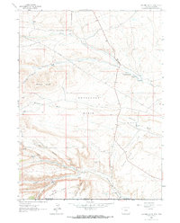
Horseshoe Basin dominates this landscape along the high border between Wyoming and Colorado, where the terrain is marked by the complex drainage of Vermillion Creek and its many tributaries. In the early 1960s, this remote area served as a focal point for both traditional ranching and emerging energy extraction. Named ranching outposts like the Rife Ranch, Scofield Ranch, and Graham Ranch are tucked into the drainages of Coyote Creek and Owl Canyon, illustrating the scattered settlement pattern of the high desert. The map captures the industrial footprint of the era through the Gas Field and the Canyon Creek Mine, alongside infrastructure like a major Pipeline and isolated features such as Canyon Creek Camp. Local landmarks like Scrivner Butte and Diamond Field provide specific geographical context for researchers tracing land use and family history in Sweetwater and Moffat counties.
Find a feature on this map
34 named features on this map. Tap any name to fly to it.
Don’t see what you’re looking for? This feature index may not catch every label — zoom into the map to look around manually.
Map Details
Editions of this 1963 Scrivner Butte Map
2 editions found
Other maps of this area

1954 · Vernal
USGS Topo · 1:250,000

1954 · Rock Springs
USGS Topo · 1:250,000

1958 · Vernal
USGS Topo · 1:250,000

1958 · Rock Springs
USGS Topo · 1:250,000

1960 · Vernal
USGS Topo · 1:250,000

1962 · Rock Springs
USGS Topo · 1:250,000

1963 · Four J Rim
USGS Topo · 1:24,000
1963 · Potter Mountain
USGS Topo · 1:24,000

1963 · Erickson-Kent Ranch
USGS Topo · 1:24,000

1966 · Sugarloaf Butte
USGS Topo · 1:24,000