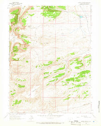
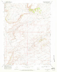
1963 Map of Potter Mountain
USGS Topo · Published 1966About this map
Pio Moses Ranch sits in the high desert of Sweetwater County, marking a rare human outpost in a landscape dominated by complex drainage systems and high ridges. Established grazing and water management are evident across the terrain, with features like Potter Mountain Reservoir and Pio Reservoir supporting livestock in an arid environment. The map details a sophisticated network of seasonal watercourses, including Dry Canyon, Brooks Draw, and West Draw, which carve through the elevations of Potter Mountain and Elk Butte. Isolated resources such as Jim Washum Spring and Laney Spring provide vital landmarks for those navigating the high country. To the south, the terrain drops toward Rifes Rim and the winding course of Salt Wells Creek, while scattered markers for a Gas Well and Drill Hole point to early exploration of the region's mineral potential.
Find a feature on this map
16 named features on this map. Tap any name to fly to it.
Don’t see what you’re looking for? This feature index may not catch every label — zoom into the map to look around manually.
Map Details
Editions of this 1963 Potter Mountain Map
2 editions found
Other maps of this area

1954 · Rock Springs
USGS Topo · 1:250,000

1958 · Rock Springs
USGS Topo · 1:250,000

1962 · Rock Springs
USGS Topo · 1:250,000
1963 · Titsworth Gap
USGS Topo · 1:24,000

1963 · Four J Rim
USGS Topo · 1:24,000
1963 · Red Creek Ranch
USGS Topo · 1:24,000

1963 · Erickson-Kent Ranch
USGS Topo · 1:24,000

1963 · Scrivner Butte
USGS Topo · 1:24,000

1968 · Mud Springs Ranch
USGS Topo · 1:24,000
1968 · South Baxter
USGS Topo · 1:24,000