
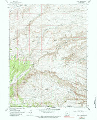
1963 Map of Four J Rim
USGS Topo · Published 1966About this map
Four J Rim dominates this high-elevation landscape along the border of Sweetwater and Moffat counties, where the high desert terrain of southern Wyoming meets northern Colorado. The 1963 survey captures a territory defined by intricate drainage systems and scarce water sources, as seen in the networks feeding Salt Wells Creek and Vermillion Creek. Isolated landmarks like Wallace Cabin and a lone Gas Well indicate the sparse human footprint in this livestock and mineral country during the mid-twentieth century.
Find a feature on this map
22 named features on this map. Tap any name to fly to it.
Don’t see what you’re looking for? This feature index may not catch every label — zoom into the map to look around manually.
Map Details
Editions of this 1963 Four J Rim Map
2 editions found
Other maps of this area

1885 · Ashley
USGS Topo · 1:250,000

1952 · Willow Creek Butte
USGS Topo · 1:24,000

1954 · Vernal
USGS Topo · 1:250,000

1954 · Rock Springs
USGS Topo · 1:250,000

1958 · Vernal
USGS Topo · 1:250,000

1958 · Rock Springs
USGS Topo · 1:250,000

1960 · Vernal
USGS Topo · 1:250,000

1962 · Rock Springs
USGS Topo · 1:250,000
1963 · Titsworth Gap
USGS Topo · 1:24,000
1963 · Potter Mountain
USGS Topo · 1:24,000