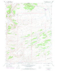
1963 Map of Potter Mountain
USGS Topo · Published 1978About this map
The high desert landscape of Sweetwater County is dominated by the massive profile of Potter Mountain and the steep escarpment of Rifes Rim in this 1963 survey. This arid environment required significant water management for ranching and resource extraction, evidenced by the distribution of remote water sources like Laney Spring, Jim Washum Spring, and the Potter Mountain Reservoir. The Pio Moses Ranch stands as a focal point of human activity in the northern portion of the map, situated near the Pio Reservoir and Pio Spring. Industrial development is noted through several scattered Gas Wells and Drill Holes, suggesting early energy exploration across the drainage basins of Dry Canyon and Brooks Draw.
Find a feature on this map
20 named features on this map. Tap any name to fly to it.
Don’t see what you’re looking for? This feature index may not catch every label — zoom into the map to look around manually.
Map Details
Editions of this 1963 Potter Mountain Map
2 editions found
Other maps of this area

1954 · Rock Springs
USGS Topo · 1:250,000

1958 · Rock Springs
USGS Topo · 1:250,000

1962 · Rock Springs
USGS Topo · 1:250,000
1963 · Titsworth Gap
USGS Topo · 1:24,000

1963 · Four J Rim
USGS Topo · 1:24,000
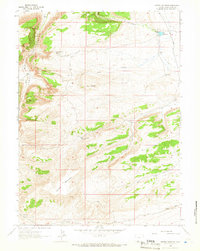
1963 · Potter Mountain
USGS Topo · 1:24,000
1963 · Red Creek Ranch
USGS Topo · 1:24,000

1963 · Erickson-Kent Ranch
USGS Topo · 1:24,000

1963 · Scrivner Butte
USGS Topo · 1:24,000

1968 · Mud Springs Ranch
USGS Topo · 1:24,000