
1966 Map of Irish Canyon
USGS Topo · Published 1969About this map
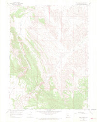
Cold Spring Ridge Mountain and the deep incision of Irish Canyon define this high-altitude landscape in the mid-1960s. The terrain is dominated by the winding course of Vermillion Creek, which cuts through the northwestern Colorado plateau. Evidence of land use is sparse, but concentrated at the Ink Springs Ranch near the southern border, where a Spring and a localized Gravel Pit suggest small-scale operations in an otherwise remote environment. The map shows the drainage patterns of Dry Creek and the localized basins of Irish Lakes below Blue Hill. This period of mapping reflects the region's character as open rangeland, marked by limited road infrastructure and seasonal water sources that supported local ranching families.
Find a feature on this map
9 named features on this map. Tap any name to fly to it.
Don’t see what you’re looking for? This feature index may not catch every label — zoom into the map to look around manually.
Map Details
Editions of this 1966 Irish Canyon Map
3 editions found
Other maps of this area

1954 · Vernal
USGS Topo · 1:250,000

1958 · Vernal
USGS Topo · 1:250,000

1960 · Vernal
USGS Topo · 1:250,000

1966 · G Spring
USGS Topo · 1:24,000

1966 · Sugarloaf Butte
USGS Topo · 1:24,000

1966 · Big Joe Basin
USGS Topo · 1:24,000
1966 · Sparks
USGS Topo · 1:24,000

1966 · Sheephead Basin
USGS Topo · 1:24,000

1966 · Hiawatha
USGS Topo · 1:24,000
1966 · Jack Springs
USGS Topo · 1:24,000