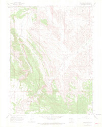
1966 Map of Irish Canyon
USGS Topo · Published 1969About this map
Irish Canyon and the massive landform of Cold Spring Ridge Mountain dominate this mid-1960s landscape in northwestern Colorado. The terrain is defined by the winding course of Vermillion Creek, which cuts through the high desert geology alongside its seasonal counterpart, Dry Creek. Human presence is sparse on this rugged terrain, anchored primarily by the Ink Springs Ranch and a lone Gravel Pit indicative of local material extraction.
Find a feature on this map
8 named features on this map. Tap any name to fly to it.
Don’t see what you’re looking for? This feature index may not catch every label — zoom into the map to look around manually.
Map Details
Editions of this 1966 Irish Canyon Map
3 editions found
Other maps of this area

1954 · Vernal
USGS Topo · 1:250,000

1958 · Vernal
USGS Topo · 1:250,000

1960 · Vernal
USGS Topo · 1:250,000

1966 · G Spring
USGS Topo · 1:24,000

1966 · Sugarloaf Butte
USGS Topo · 1:24,000

1966 · Big Joe Basin
USGS Topo · 1:24,000
1966 · Sparks
USGS Topo · 1:24,000

1966 · Irish Canyon
USGS Topo · 1:24,000

1966 · Sheephead Basin
USGS Topo · 1:24,000

1966 · Hiawatha
USGS Topo · 1:24,000