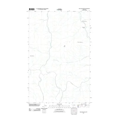
2011 Map of Big John Butte
USGS Topo · Published 2011About this map
The northern slopes of the Bears Paw Mountains define this section of Hill County, where the landscape is marked by prominent high points like Big John Butte and Moses Mountain. In this 2011 survey, the drainage patterns of the high plains are clearly visible, as headwaters such as West Fork Birch Creek and East Fork Beaver Creek move away from the central peaks. Navigation through this upland terrain follows established backcountry routes including Little Boxelder Creek Rd and Clear Creek Rd, which parallel the winding courses of their namesake waterways. The map illustrates the convergence of several significant forks, such as West Fork Clear Creek, as they exit deep-cut features like White Pine Canyon and Greenough Coulee to the northeast.
Find a feature on this map
14 named features on this map. Tap any name to fly to it.
Don’t see what you’re looking for? This feature index may not catch every label — zoom into the map to look around manually.
Map Details
Editions of this 2011 Big John Butte Map
This is the sole edition of this map. No revisions or reprints were ever made.
Other maps of this area

1953 · Havre
USGS Topo · 1:250,000

1956 · Maddux
USGS Topo · 1:62,500

1956 · Lloyd
USGS Topo · 1:62,500

1957 · Havre
USGS Topo · 1:250,000

1958 · Havre
USGS Topo · 1:250,000

1959 · Warrick
USGS Topo · 1:62,500

1959 · Shambo
USGS Topo · 1:62,500
1984 · Bearpaw Lake
USGS Topo · 1:24,000

1984 · Big John Butte
USGS Topo · 1:24,000
1984 · Shambo SE
USGS Topo · 1:24,000