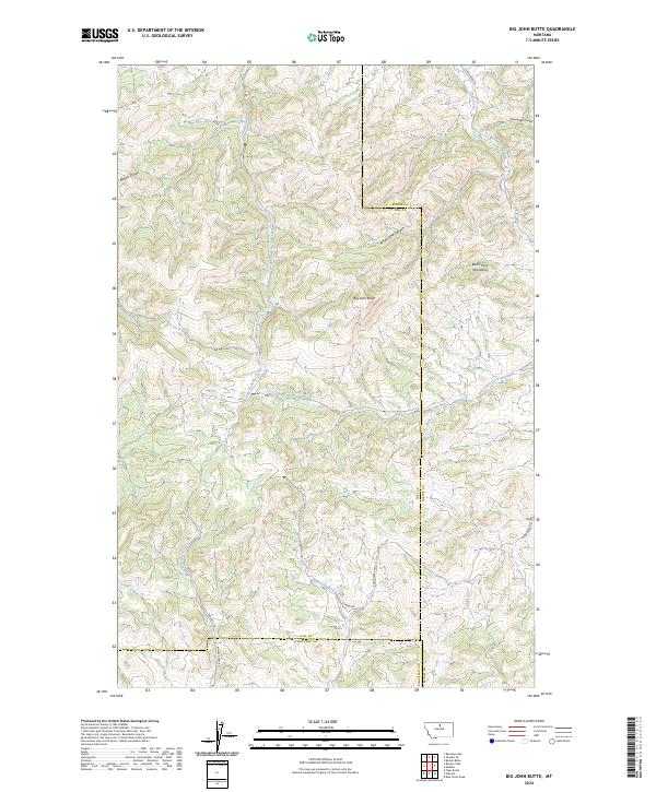
2024 Map of Big John Butte
USGS Topo · Published 2024About this map
Big John Butte serves as a prominent high point in this high-plains landscape where Hill, Blaine, and Chouteau counties meet. The terrain is defined by the northern reaches of the Bears Paw Mountains, a region characterized by deep drainage systems like White Pine Canyon and numerous coulees, including Blackie Coulee and Greenough Coulee. These features shape a complex network of seasonal and perennial watercourses that feed into larger systems such as Little Boxelder Creek and the East Fork Birch Creek.
Find a feature on this map
26 named features on this map. Tap any name to fly to it.
Don’t see what you’re looking for? This feature index may not catch every label — zoom into the map to look around manually.
Map Details
Editions of this 2024 Big John Butte Map
This is the sole edition of this map. No revisions or reprints were ever made.
Other maps of this area

1953 · Havre
USGS Topo · 1:250,000

1956 · Maddux
USGS Topo · 1:62,500

1956 · Lloyd
USGS Topo · 1:62,500

1957 · Havre
USGS Topo · 1:250,000

1958 · Havre
USGS Topo · 1:250,000

1959 · Warrick
USGS Topo · 1:62,500

1959 · Shambo
USGS Topo · 1:62,500
1984 · Bearpaw Lake
USGS Topo · 1:24,000

1984 · Big John Butte
USGS Topo · 1:24,000
1984 · Shambo SE
USGS Topo · 1:24,000