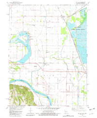
1981 Map of Big Lake
USGS Topo · Published 1982About this map
Big Lake State Park and the expansive wetlands of the Squaw Creek National Wildlife Refuge anchor this Missouri River floodplain survey. The landscape is defined by the shifting hydrology of the Missouri River and its various oxbows and drainage channels, including Little Tarkio Creek and Squaw Creek. The region’s agricultural and transportation backbone is evident in the straight-line grid of rural roads and the Burlington Northern railroad corridor, which connects small settlements like Bigelow, Fortescue, and Napier. Local genealogy is well-preserved through family-named landmarks and historical sites such as Tarkio Chapel Cem, Laukemper Cem, and Catron Cem. The map also delineates the Iowa Sac and Fox Indian Reservation Boundary, reflecting the complex historical geography of the border region between Missouri and Nebraska.
Find a feature on this map
28 named features on this map. Tap any name to fly to it.
Don’t see what you’re looking for? This feature index may not catch every label — zoom into the map to look around manually.
Map Details
Editions of this 1981 Big Lake Map
This is the sole edition of this map. No revisions or reprints were ever made.
Other maps of this area

1885 · Atchison
USGS Topo · 1:125,000

1888 · Atchison
USGS Topo · 1:125,000

1893 · Atchison
USGS Topo · 1:125,000

1920 · Craig
USGS Topo · 1:62,500

1926 · Oregon
USGS Topo · 1:62,500

1926 · Maitland
USGS Topo · 1:62,500

1950 · Kansas City
USGS Topo · 1:250,000

1954 · Kansas City
USGS Topo · 1:250,000

1955 · Nebraska City
USGS Topo · 1:250,000

1956 · Kansas City
USGS Topo · 1:250,000