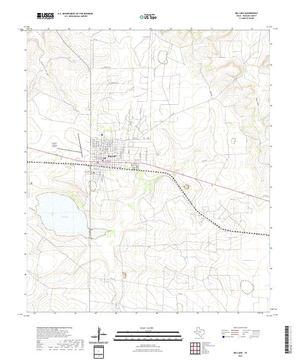
2022 Map of Big Lake
USGS Topo · Published 2022About this map
Reagan County Courthouse anchors the grid of Big Lake, serving as the seat of local government in this semi-arid Texas landscape. The town is situated on a plateau overlooking its namesake Big Lake, an ephemeral water body fed by Big Lake Draw. This 2022 survey captures the community’s infrastructure, from the Reagan County Airport on the western outskirts to the quiet grounds of Glen Rest Cem south of the main thoroughfares. The surrounding terrain is defined by dramatic drainage systems like Taylor Draw and Isaac Draw, which carve through the high plains. A network of rural roads such as Scott Rd and Pembrook Rd connects the town to the broader Permian Basin region, while the layout of streets like S Railroad St reflects the historical importance of the rail corridor through the center of the settlement.
Find a feature on this map
50 named features on this map. Tap any name to fly to it.
Don’t see what you’re looking for? This feature index may not catch every label — zoom into the map to look around manually.
Map Details
Editions of this 2022 Big Lake Map
This is the sole edition of this map. No revisions or reprints were ever made.
Other maps of this area

1920 · Big Lake
USGS Topo · 1:62,500

1922 · Big Lake
USGS Topo · 1:62,500

1928 · Rankin
USGS Topo · 1:125,000

1954 · San Angelo
USGS Topo · 1:250,000

1958 · San Angelo
USGS Topo · 1:250,000

1965 · San Angelo
USGS Topo · 1:250,000

1970 · South Mustang Draw SE
USGS Topo · 1:24,000
1970 · Texon SE
USGS Topo · 1:24,000

1970 · Gardener Draw
USGS Topo · 1:24,000
1970 · Divide Draw
USGS Topo · 1:24,000