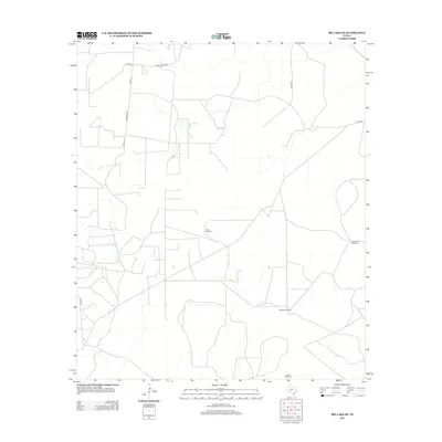
2012 Map of Big Lake SE
USGS Topo · Published 2012About this map
Isolated windmills and ranch access roads define this section of the Texas backcountry in Crockett County. The landscape is structured around a network of essential water sources for livestock, including West Windmill, Twelvefoot Windmill, Williams Windmill, and Coates Windmill. These named landmarks serve as primary navigation points in an otherwise sparse terrain. Transport through the area relies on a grid of local corridors such as Ranch House Rd and Ferguson Ln, alongside several county routes like Co Rd-10 and Co Rd-147. The concentration of water-lifting infrastructure and specific ranch-named roads like Elkins Rd reflects a well-established cattle ranching economy where property access and reliable water are the critical components of the rural settlement pattern.
Find a feature on this map
11 named features on this map. Tap any name to fly to it.
Don’t see what you’re looking for? This feature index may not catch every label — zoom into the map to look around manually.
Map Details
Editions of this 2012 Big Lake SE Map
This is the sole edition of this map. No revisions or reprints were ever made.
Other maps of this area

1920 · Big Lake
USGS Topo · 1:62,500

1920 · Barnhart
USGS Topo · 1:62,500

1922 · Big Lake
USGS Topo · 1:62,500

1922 · Barnhart
USGS Topo · 1:62,500

1954 · Sonora
USGS Topo · 1:250,000

1954 · San Angelo
USGS Topo · 1:250,000

1958 · Sonora
USGS Topo · 1:250,000

1958 · San Angelo
USGS Topo · 1:250,000

1965 · San Angelo
USGS Topo · 1:250,000

1967 · Schneeman Draw NW
USGS Topo · 1:24,000