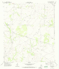
1971 Map of Big Lake SE
USGS Topo · Published 1974About this map
The intersection of the Reagan, Crockett, and Irion County lines marks this high plains terrain during the early 1970s. The landscape is defined by the energy and ranching industries, characterized by an extensive network of pipelines and numerous extraction sites including Gas Wells and Oil Wells. The arroyo systems of Tepee Draw and the East Fork Howard Draw cut through the topography, providing the primary drainage for the region.
Find a feature on this map
16 named features on this map. Tap any name to fly to it.
Don’t see what you’re looking for? This feature index may not catch every label — zoom into the map to look around manually.
Map Details
Editions of this 1971 Big Lake SE Map
This is the sole edition of this map. No revisions or reprints were ever made.
Other maps of this area

1920 · Big Lake
USGS Topo · 1:62,500

1920 · Barnhart
USGS Topo · 1:62,500

1922 · Big Lake
USGS Topo · 1:62,500

1922 · Barnhart
USGS Topo · 1:62,500

1954 · Sonora
USGS Topo · 1:250,000

1954 · San Angelo
USGS Topo · 1:250,000

1958 · Sonora
USGS Topo · 1:250,000

1958 · San Angelo
USGS Topo · 1:250,000

1965 · San Angelo
USGS Topo · 1:250,000

1967 · Schneeman Draw NW
USGS Topo · 1:24,000