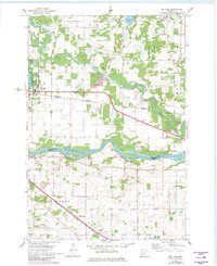
1961 Map of Big Lake
USGS Topo · Published 1980About this map
The Mississippi River forms a significant geographical boundary between Sherburne and Wright Counties, anchoring this landscape as it transitions from river bottomlands to the glacial lake plains. The settlement of Big Lake is the primary hub of activity, situated alongside its namesake water body and Lake Mitchell. The map illustrates the region's transport reliance on both water and rail, with the Great Northern and Pacific Northern lines cutting through the terrain. Just north of the river, the village of Bailey and the Landing Strip near the Elk River show the mid-century infrastructure of this central Minnesota corridor. The presence of numerous Gravel Pits reflects the local extractive economy, while water bodies like Preusse Lake and Birch Lake characterize the post-glacial topography north of the river valley.
Find a feature on this map
27 named features on this map. Tap any name to fly to it.
Don’t see what you’re looking for? This feature index may not catch every label — zoom into the map to look around manually.
Map Details
Editions of this 1961 Big Lake Map
2 editions found
Other maps of this area

1909 · Rockford
USGS Topo · 1:62,500

1953 · Stillwater
USGS Topo · 1:250,000

1955 · Stillwater
USGS Topo · 1:250,000

1958 · Stillwater
USGS Topo · 1:250,000

1958 · Rockford
USGS Topo · 1:62,500

1958 · Buffalo
USGS Topo · 1:62,500

1961 · Big Lake
USGS Topo · 1:24,000

1961 · Orrock
USGS Topo · 1:24,000

1961 · Lake Fremont
USGS Topo · 1:24,000

1961 · Elk River
USGS Topo · 1:24,000