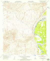
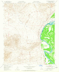
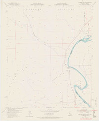
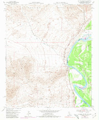
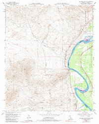
1954 Map of Big Maria Mts. NE
USGS Topo · Published 1956About this map
The Colorado River snakes along the California and Arizona border in this mid-century survey, defining the eastern edge of the Colorado River Indian Reservation. The terrain is dominated by the sharp elevations of the Riverside Mountains and the Big Maria Mountains, which rise steeply from the desert floor. Landmark features like Quien Sabe Point provide clear navigational markers amidst a network of desert drainages including Big Wash and Slaughter Tree Wash. Human presence is concentrated near the water's edge at Water Wheel Camp and Hall Island. This era of mapping captured the remote character of the region before significant modern development, with the Old Blythe-Vidal Road serving as the primary overland artery through the arid landscape.
Find a feature on this map
14 named features on this map. Tap any name to fly to it.
Don’t see what you’re looking for? This feature index may not catch every label — zoom into the map to look around manually.
Map Details
Editions of this 1954 Big Maria Mts. NE Map
6 editions found

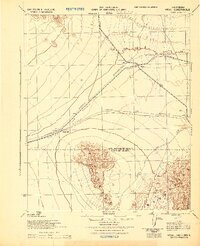
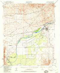
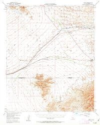
Other maps of this area

1911 · Parker
USGS Topo · 1:125,000

1931 · Moon Mtn
USGS Topo · 1:62,500

1932 · Moon Mtn
USGS Topo · 1:62,500

1942 · Blythe
USGS Topo · 1:250,000

1942 · MOON MTN
USGS Topo · 1:62,500

1943 · Parker
USGS Topo · 1:62,500
1943 · Vidal
USGS Topo · 1:62,500

1945 · Big Maria Mtns
USGS Topo · 1:62,500
1949 · Parker
USGS Topo · 1:62,500
1949 · Vidal
USGS Topo · 1:62,500