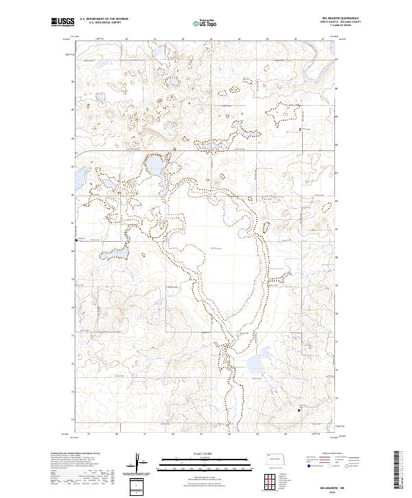
2024 Map of Big Meadow
USGS Topo · Published 2024About this map
Big Meadow and its surrounding wetlands dominate this landscape in the northern plains of Williams County. Managed largely as part of the Williams County Waterfowl Production Area, the terrain is defined by a high density of small basins and prairie potholes, a signature of the region's glacial history. This land-use pattern prioritizes habitat conservation, with the large contiguous blocks of the production area interspersed among the section-line roads of the Public Land Survey System. For genealogists and local historians, several rural burial sites remain preserved across the townships, including Stordahl Lutheran Cem and Saint Olaf Cem in the south, alongside Grong Cem to the northeast. These small cemeteries, often associated with early Norwegian Lutheran congregations, serve as the primary markers of the area's pioneer-era settlement history.
Find a feature on this map
28 named features on this map. Tap any name to fly to it.
Don’t see what you’re looking for? This feature index may not catch every label — zoom into the map to look around manually.
Map Details
Editions of this 2024 Big Meadow Map
This is the sole edition of this map. No revisions or reprints were ever made.
Other maps of this area

1911 · Ray
USGS Topo · 1:125,000

1953 · Williston
USGS Topo · 1:250,000

1957 · Williston
USGS Topo · 1:250,000

1974 · Wildrose
USGS Topo · 1:24,000

1974 · Tom Berg Lake
USGS Topo · 1:24,000

1974 · Hamlet
USGS Topo · 1:24,000

1974 · McGregor
USGS Topo · 1:24,000
1974 · Bush Lake
USGS Topo · 1:24,000

1974 · Big Meadow
USGS Topo · 1:24,000

1978 · Temple
USGS Topo · 1:24,000