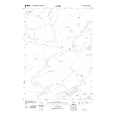
2010 Map of Big Moose
USGS Topo · Published 2010About this map
Big Moose serves as a central hub in this landscape of the central Adirondacks, where seasonal camps and remote settlements are connected by a network of winding forest roads. The area around Camp Rondaxe and Lake Rondaxe reflects the long-standing tradition of lakefront retreats, while the higher elevations are defined by prominent peaks like Twitchell Mountain and Slide Off Mountain.
Find a feature on this map
55 named features on this map. Tap any name to fly to it.
Don’t see what you’re looking for? This feature index may not catch every label — zoom into the map to look around manually.
Map Details
Editions of this 2010 Big Moose Map
This is the sole edition of this map. No revisions or reprints were ever made.
Other maps of this area

1901 · Old Forge
USGS Topo · 1:62,500

1903 · Big Moose
USGS Topo · 1:62,500

1912 · Number Four
USGS Topo · 1:62,500

1912 · Mc Keever
USGS Topo · 1:62,500

1915 · Number Four
USGS Topo · 1:62,500

1950 · Utica
USGS Topo · 1:250,000

1954 · Old Forge
USGS Topo · 1:62,500

1954 · Big Moose
USGS Topo · 1:62,500

1957 · Utica
USGS Topo · 1:250,000
1957 · Number Four
USGS Topo · 1:62,500