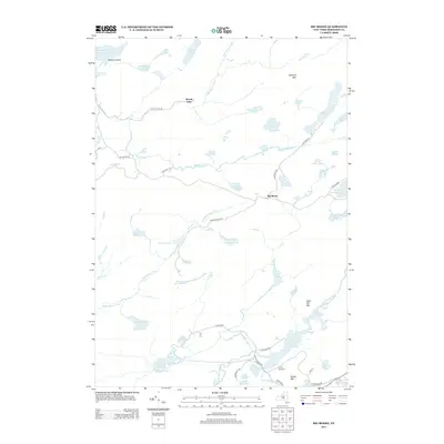
2013 Map of Big Moose
USGS Topo · Published 2013About this map
Big Moose and Woods Lake serve as the primary hubs of activity in this Adirondack landscape, which is defined by an intricate network of water bodies and primitive trails. The northeastern corner is dominated by the sprawling Twitchell Lake and the peak of Twitchell Mtn, while the southwestern section features the Independence River flowing through Lyons Marsh toward Independence Lake.
Find a feature on this map
63 named features on this map. Tap any name to fly to it.
Don’t see what you’re looking for? This feature index may not catch every label — zoom into the map to look around manually.
Map Details
Editions of this 2013 Big Moose Map
This is the sole edition of this map. No revisions or reprints were ever made.
Other maps of this area

1901 · Old Forge
USGS Topo · 1:62,500

1903 · Big Moose
USGS Topo · 1:62,500

1912 · Number Four
USGS Topo · 1:62,500

1912 · Mc Keever
USGS Topo · 1:62,500

1915 · Number Four
USGS Topo · 1:62,500

1950 · Utica
USGS Topo · 1:250,000

1954 · Old Forge
USGS Topo · 1:62,500

1954 · Big Moose
USGS Topo · 1:62,500

1957 · Utica
USGS Topo · 1:250,000
1957 · Number Four
USGS Topo · 1:62,500