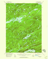
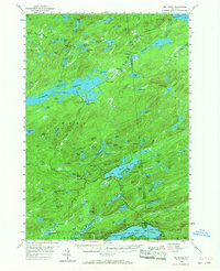
1954 Map of Big Moose
USGS Topo · Published 1964About this map
The Stillwater Reservoir dominates this 1954 survey, its irregular shoreline reaching deep into the forested interior where the New York Central railroad provides the primary link between isolated settlements. This remote landscape in the Adirondack State Park is defined by a dense network of water bodies, from large lakes like Lake Lila and Big Moose to smaller basins like Sitz Pond and Negro Lake. The railroad corridor supports small outposts such as Beaver River, Brandreth, and Carter Station, illustrating a period when rail travel was essential for accessing seasonal camps and private estates in the northern woods.
Find a feature on this map
129 named features on this map. Tap any name to fly to it.
Don’t see what you’re looking for? This feature index may not catch every label — zoom into the map to look around manually.
Map Details
Editions of this 1954 Big Moose Map
6 editions found

Other maps of this area

1900 · Canada Lake
USGS Topo · 1:62,500

1901 · Old Forge
USGS Topo · 1:62,500

1903 · Big Moose
USGS Topo · 1:62,500

1903 · West Canada Lakes
USGS Topo · 1:62,500

1903 · Raquette Lake
USGS Topo · 1:62,500

1907 · Tupper Lake
USGS Topo · 1:62,500

1912 · Number Four
USGS Topo · 1:62,500

1912 · Mc Keever
USGS Topo · 1:62,500

1915 · Number Four
USGS Topo · 1:62,500

1916 · Oswegatchie
USGS Topo · 1:62,500