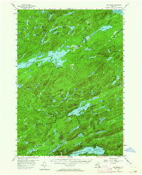
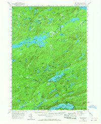
1954 Map of Big Moose
USGS Topo · Published 1968About this map
The New York Central railroad corridor anchors this mid-century survey of the Adirondack wilderness, connecting isolated stops like Keepawa, Brandreth, and Little Rapids through dense lake country. The expansive Stillwater Reservoir dominates the western half of the sheet, while to the south, the settlements of Eagle Bay and Inlet mark the more developed recreational edges of the quadrangle. The map reveals a landscape defined by water and rail, where places like Beaver River and Norridgewock existed primarily as points along the tracks. Higher elevations such as Twitchell Mtn and Mt Electra overlook a network of countless named basins, including Willys Lake and Salmon Lake. This documentation captures the area shortly after the mid-1950s field checks, showing the distribution of summer camps and backcountry stations before modern expansion altered these remote Herkimer County corridors.
Find a feature on this map
143 named features on this map. Tap any name to fly to it.
Don’t see what you’re looking for? This feature index may not catch every label — zoom into the map to look around manually.
Map Details
Editions of this 1954 Big Moose Map
6 editions found

Other maps of this area

1900 · Canada Lake
USGS Topo · 1:62,500

1901 · Old Forge
USGS Topo · 1:62,500

1903 · Big Moose
USGS Topo · 1:62,500

1903 · West Canada Lakes
USGS Topo · 1:62,500

1903 · Raquette Lake
USGS Topo · 1:62,500

1907 · Tupper Lake
USGS Topo · 1:62,500

1912 · Number Four
USGS Topo · 1:62,500

1912 · Mc Keever
USGS Topo · 1:62,500

1915 · Number Four
USGS Topo · 1:62,500

1916 · Oswegatchie
USGS Topo · 1:62,500