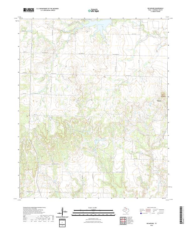
2022 Map of Big Mound
USGS Topo · Published 2022About this map
Lake Pauline and the prominent Medicine Mounds landmarks anchor this rural landscape in Hardeman County, Texas. The terrain is defined by the winding course of Wanderers Creek and its southern fork, which feed into the lake near the northern boundary. Cattle ranching and land ownership patterns are visible through family-named features and infrastructure, such as the Mrs J H Williams Ranch Lake and roads like Hurst Williams Rd and Smith Ranch Rd. The eastern portion of the area rises toward Big Mound, a distinctive high point overlooking the network of seasonal drainages including Cottonwood Cr and Hackberry Cr. A grid of rural routes like Wolf Hunt Rd and Four Corners Rd connects scattered farmsteads, reflecting the enduring agricultural character of this North Texas region.
Find a feature on this map
30 named features on this map. Tap any name to fly to it.
Don’t see what you’re looking for? This feature index may not catch every label — zoom into the map to look around manually.
Map Details
Editions of this 2022 Big Mound Map
This is the sole edition of this map. No revisions or reprints were ever made.
Other maps of this area

1927 · Quanah 3-a
USGS Topo · 1:48,000

1932 · Vivian
USGS Topo · 1:62,500

1955 · Lawton
USGS Topo · 1:250,000

1958 · Medicine Mound
USGS Topo · 1:62,500

1960 · Goodlett
USGS Topo · 1:62,500

1960 · Teacup Mountain
USGS Topo · 1:62,500

1960 · Quanah
USGS Topo · 1:62,500

1983 · Warrior Hollow
USGS Topo · 1:24,000

1983 · Big Mound
USGS Topo · 1:24,000
1983 · Margaret
USGS Topo · 1:24,000