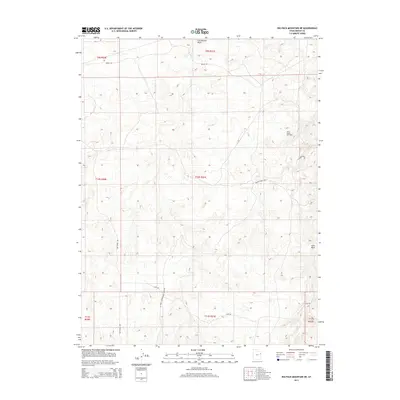
2014 Map of Big Pack Mountain NE
USGS Topo · Published 2014About this map
The Bitter Creek Gas Field serves as a primary industrial landmark in this remote corner of Uintah County, illustrating the modern energy landscape of northeastern Utah. The topography is defined by a series of drainage systems, most notably Cottonwood Wash in the north and Sand Wash to the southeast, which carve through the high plateau. The network of unimproved and secondary roads, such as Seep Ridge Rd and Bitter Creek Rd, highlights the area's utility for resource extraction and land management. While largely unsettled by permanent communities, the infrastructure suggests a region shaped by petroleum development and seasonal access. Historical boundaries for several townships are visible, including t10s r21e and t11s r21e, providing a precise framework for researchers and land-use historians studying the evolution of public lands in the Uinta Basin.
Find a feature on this map
16 named features on this map. Tap any name to fly to it.
Don’t see what you’re looking for? This feature index may not catch every label — zoom into the map to look around manually.
Map Details
Editions of this 2014 Big Pack Mountain NE Map
This is the sole edition of this map. No revisions or reprints were ever made.
Other maps of this area

1885 · East Tavaputs
USGS Topo · 1:250,000

1885 · Ashley
USGS Topo · 1:250,000

1907 · Jensen
USGS Topo · 1:125,000

1910 · Jensen
USGS Topo · 1:125,000

1917 · Vernal
USGS Topo · 1:125,000

1954 · Vernal
USGS Topo · 1:250,000

1956 · Grand Junction
USGS Topo · 1:250,000

1958 · Vernal
USGS Topo · 1:250,000

1959 · Grand Junction
USGS Topo · 1:250,000

1960 · Vernal
USGS Topo · 1:250,000