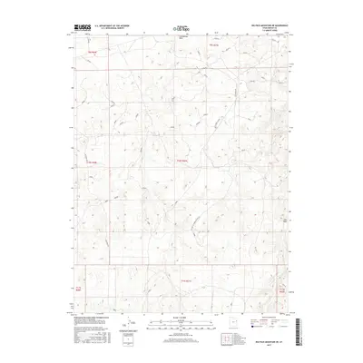
2017 Map of Big Pack Mountain NE
USGS Topo · Published 2017About this map
Cottonwood Wash and its associated drainages define this high-desert territory in the Uintah Basin, as documented by the U.S. Geological Survey in the early 21st century. The landscape is marked by a network of drainage basins including Sand Wash and the distinct path of the W Fork Cottonwood Wash Rd. This area of eastern Utah is characterized by its reliance on a specific road system for transit across the mesas, including the prominent Seep Ridge Rd and the junction of Glen Bench Rd with the Glen Bench Cutoff. The map provides an essential look at the modern land management grid, overlaying township and range boundaries such as t10s r21e and t11s r21e upon the naturally carved topography of the basin.
Find a feature on this map
15 named features on this map. Tap any name to fly to it.
Don’t see what you’re looking for? This feature index may not catch every label — zoom into the map to look around manually.
Map Details
Editions of this 2017 Big Pack Mountain NE Map
This is the sole edition of this map. No revisions or reprints were ever made.
Other maps of this area

1885 · East Tavaputs
USGS Topo · 1:250,000

1885 · Ashley
USGS Topo · 1:250,000

1907 · Jensen
USGS Topo · 1:125,000

1910 · Jensen
USGS Topo · 1:125,000

1917 · Vernal
USGS Topo · 1:125,000

1954 · Vernal
USGS Topo · 1:250,000

1956 · Grand Junction
USGS Topo · 1:250,000

1958 · Vernal
USGS Topo · 1:250,000

1959 · Grand Junction
USGS Topo · 1:250,000

1960 · Vernal
USGS Topo · 1:250,000