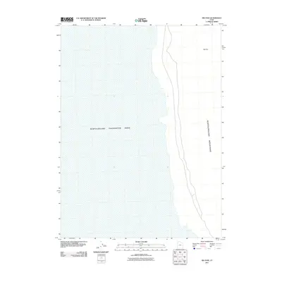
2011 Map of Big Pass
USGS Topo · Published 2011About this map
The Newfoundland Evaporation Basin dominates the western half of this landscape, illustrating the industrial and hydrographic character of the Great Salt Lake Desert region. This 2011 survey captures the interface between the massive water management infrastructure and the natural rise of the Newfoundland Mountains to the east. The terrain is marked by the distinct geographical break of Big Pass, a narrow corridor that separates the higher elevations of the range. The map reveals the precise boundaries where the artificial evaporation pools meet the shoreline, reflecting the large-scale mineral extraction and water diversion processes central to the geography of Tooele County.
Find a feature on this map
3 named features on this map. Tap any name to fly to it.
Don’t see what you’re looking for? This feature index may not catch every label — zoom into the map to look around manually.
Map Details
Editions of this 2011 Big Pass Map
This is the sole edition of this map. No revisions or reprints were ever made.
Other maps of this area

1953 · Tooele
USGS Topo · 1:250,000

1954 · Brigham City
USGS Topo · 1:250,000

1955 · Tooele
USGS Topo · 1:250,000

1958 · Brigham City
USGS Topo · 1:250,000

1962 · Brigham City
USGS Topo · 1:250,000

1973 · Knolls 2 NW
USGS Topo · 1:24,000

1973 · Knolls 2 NE
USGS Topo · 1:24,000

1973 · Floating Island NE
USGS Topo · 1:24,000
1979 · Bonneville Salt Flats
USGS Topo · 1:100,000

1983 · Desert Peak
USGS Topo · 1:24,000