
1973 Map of Knolls 2 NW
USGS Topo · Published 1977About this map
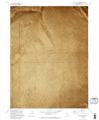
The expansive Hill Air Force Range dominates this landscape in the early 1970s, illustrating the military's extensive footprint in the Great Salt Lake Desert. Straddling the border of Box Elder Co and Tooele Co, the terrain is defined by its extreme uniformity and environmental severity. The surface consists primarily of a wide Mud Flat, a geological feature that reflects the prehistoric lakebed history of the region. This orthophotomap, derived from 1972 aerial photography, provides a literal visual record of the ground texture, revealing subtle variations in the salt and silt crust. Apart from the designated military range and the prominent topographic rise known simply as Hill, the area remains largely devoid of human infrastructure or permanent settlements, emphasizing the isolation required for strategic defense operations during this era.
Find a feature on this map
4 named features on this map. Tap any name to fly to it.
Don’t see what you’re looking for? This feature index may not catch every label — zoom into the map to look around manually.
Map Details
Editions of this 1973 Knolls 2 NW Map
2 editions found
Other maps of this area

1953 · Tooele
USGS Topo · 1:250,000

1954 · Brigham City
USGS Topo · 1:250,000

1955 · Tooele
USGS Topo · 1:250,000

1958 · Brigham City
USGS Topo · 1:250,000

1962 · Brigham City
USGS Topo · 1:250,000

1973 · Floating Island SE
USGS Topo · 1:24,000

1973 · Knolls 2 NE
USGS Topo · 1:24,000

1973 · Floating Island NE
USGS Topo · 1:24,000

1973 · Knolls 2 SW
USGS Topo · 1:24,000
1973 · North of Knolls
USGS Topo · 1:24,000