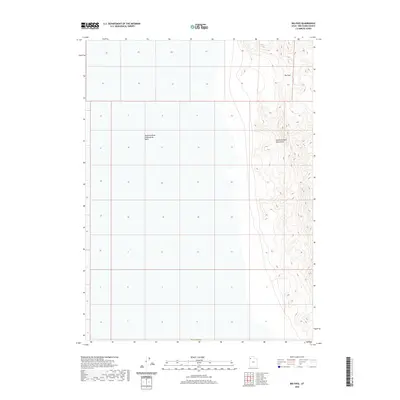
2020 Map of Big Pass
USGS Topo · Published 2020About this map
The Newfoundland Mountains dominate the eastern half of this terrain, rising sharply above the stark landscape of the west. To the west lies the Newfoundland Evaporation Basin, a prominent feature of the Great Salt Lake Desert region. This 2020 survey illustrates the transition from the high, craggy peaks of the range to the expansive flats of the basin floor. A critical geographical corridor, Big Pass, provides a natural break in the mountain chain, serving as a historical waypoint for navigation through this arid part of Northern Utah. While the map primarily covers Tooele County, it also tracks the northern boundary of Box Elder Co, marking the jurisdictional intersection in this sparsely populated desert environment.
Find a feature on this map
4 named features on this map. Tap any name to fly to it.
Don’t see what you’re looking for? This feature index may not catch every label — zoom into the map to look around manually.
Map Details
Editions of this 2020 Big Pass Map
This is the sole edition of this map. No revisions or reprints were ever made.
Other maps of this area

1953 · Tooele
USGS Topo · 1:250,000

1954 · Brigham City
USGS Topo · 1:250,000

1955 · Tooele
USGS Topo · 1:250,000

1958 · Brigham City
USGS Topo · 1:250,000

1962 · Brigham City
USGS Topo · 1:250,000

1973 · Knolls 2 NW
USGS Topo · 1:24,000

1973 · Knolls 2 NE
USGS Topo · 1:24,000

1973 · Floating Island NE
USGS Topo · 1:24,000
1979 · Bonneville Salt Flats
USGS Topo · 1:100,000

1983 · Desert Peak
USGS Topo · 1:24,000