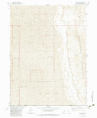
1983 Map of Big Pass
USGS Topo · Published 1983About this map
Hill Air Force Range occupies a significant portion of this desert terrain, where the boundary between Box Elder and Tooele counties cuts across the arid landscape. The map highlights the sharp contrast between the level expanse of the Mud Flat and the rising peaks of the Newfoundland Mountains, which dominate the eastern portion of the sheet. At the transition point between these elevations lies Big Pass, a notable geographic corridor through the ridge. Human activity is largely defined by military and aviation infrastructure, indicated by a remote Landing Strip positioned at the mountain base. This 1983 edition documents the area during a period of ongoing military utility and geological study, capturing the intersection of state-managed land and the natural barriers of the western Utah desert.
Find a feature on this map
6 named features on this map. Tap any name to fly to it.
Don’t see what you’re looking for? This feature index may not catch every label — zoom into the map to look around manually.
Map Details
Editions of this 1983 Big Pass Map
This is the sole edition of this map. No revisions or reprints were ever made.
Other maps of this area

1953 · Tooele
USGS Topo · 1:250,000

1954 · Brigham City
USGS Topo · 1:250,000

1955 · Tooele
USGS Topo · 1:250,000

1958 · Brigham City
USGS Topo · 1:250,000

1962 · Brigham City
USGS Topo · 1:250,000

1973 · Knolls 2 NW
USGS Topo · 1:24,000

1973 · Knolls 2 NE
USGS Topo · 1:24,000

1973 · Floating Island NE
USGS Topo · 1:24,000
1979 · Bonneville Salt Flats
USGS Topo · 1:100,000

1983 · Desert Peak
USGS Topo · 1:24,000