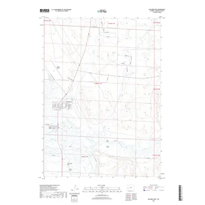
2017 Map of Big Piney East
USGS Topo · Published 2017About this map
Marbleton and the neighboring settlement of Big Piney serve as the primary hubs in this Sublette County landscape. The area is defined by a dense network of watercourses, including the Green River, which flows through the eastern portion of the quadrangle, and multiple branches such as N Piney Cr and Middle Piney Cr. The infrastructure reflects a mix of aviation and industry, with Miley Memorial Field and Big Piney Airport Rd serving the region alongside several industrial access ways like Energy Rd and Industrial Rd. To the south, the terrain becomes more varied with features like New Spring Gulch, Spring Gulch, and Bray Draw, indicating the natural drainage patterns that flow toward the river. Notable landmarks such as Ferry Island suggest a history of river crossings in an area otherwise dominated by open range and ranch roads like Fear Rd and Chizzler Rd.
Find a feature on this map
53 named features on this map. Tap any name to fly to it.
Don’t see what you’re looking for? This feature index may not catch every label — zoom into the map to look around manually.
Map Details
Editions of this 2017 Big Piney East Map
This is the sole edition of this map. No revisions or reprints were ever made.
Other maps of this area

1939 · Big Piney
USGS Topo · 1:125,000

1942 · Big Piney
USGS Topo · 1:125,000

1955 · Preston
USGS Topo · 1:250,000

1955 · Lander
USGS Topo · 1:250,000

1958 · Lander
USGS Topo · 1:250,000

1958 · Preston
USGS Topo · 1:250,000

1961 · Lander
USGS Topo · 1:250,000

1962 · Preston
USGS Topo · 1:250,000

1964 · Ross Butte
USGS Topo · 1:24,000

1964 · Mesa Spring
USGS Topo · 1:24,000