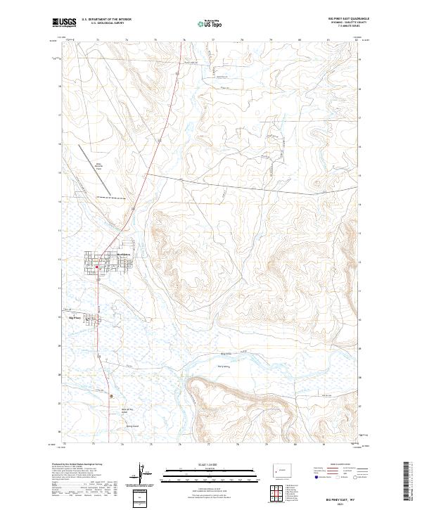
2021 Map of Big Piney East
USGS Topo · Published 2021About this map
Agricultural life and the energy industry converge near Big Piney and Marbleton in this western Wyoming landscape. The map highlights a complex network of water management essential for high-desert ranching, including the Highline Canal, Tarter Ditch, and Midmermac Ditch, which redirect flow from the Green River and its various forks like N Piney Cr. While the town grids are clearly defined, the surrounding sections are marked by industrial infrastructure such as Energy Rd and Industrial Rd, reflecting the regional importance of the local oil and gas fields.
Find a feature on this map
58 named features on this map. Tap any name to fly to it.
Don’t see what you’re looking for? This feature index may not catch every label — zoom into the map to look around manually.
Map Details
Editions of this 2021 Big Piney East Map
This is the sole edition of this map. No revisions or reprints were ever made.
Other maps of this area

1939 · Big Piney
USGS Topo · 1:125,000

1942 · Big Piney
USGS Topo · 1:125,000

1955 · Preston
USGS Topo · 1:250,000

1955 · Lander
USGS Topo · 1:250,000

1958 · Lander
USGS Topo · 1:250,000

1958 · Preston
USGS Topo · 1:250,000

1961 · Lander
USGS Topo · 1:250,000

1962 · Preston
USGS Topo · 1:250,000

1964 · Ross Butte
USGS Topo · 1:24,000

1964 · Mesa Spring
USGS Topo · 1:24,000