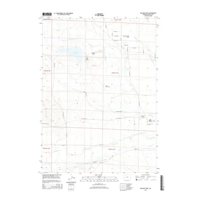
2015 Map of Big Piney West
USGS Topo · Published 2015About this map
N Piney Cr and its parallel tributaries, Middle Piney Cr and S Piney Cr, dominate this high-plains landscape west of the Green River valley. The hydrology of the region is further defined by the Sixty-Seven Reservoir and the drainage patterns of McNinch Wash and Meadow Canyon Swale. Local landmarks like DB Budd Butte and Sixty-Seven Butte rise above the basin floor, providing vertical relief in a terrain primarily organized by large-scale ranching and grazing allotments.
Find a feature on this map
41 named features on this map. Tap any name to fly to it.
Don’t see what you’re looking for? This feature index may not catch every label — zoom into the map to look around manually.
Map Details
Editions of this 2015 Big Piney West Map
This is the sole edition of this map. No revisions or reprints were ever made.
Other maps of this area

1939 · Big Piney
USGS Topo · 1:125,000

1942 · Big Piney
USGS Topo · 1:125,000

1955 · Preston
USGS Topo · 1:250,000

1958 · Preston
USGS Topo · 1:250,000

1962 · Preston
USGS Topo · 1:250,000

1969 · Chimney Butte
USGS Topo · 1:24,000
1969 · Milleson Draw
USGS Topo · 1:24,000

1969 · Cretaceous Mountain
USGS Topo · 1:24,000
1970 · Budd Reservoir
USGS Topo · 1:24,000
1970 · Big Piney West
USGS Topo · 1:24,000