
1969 Map of Cretaceous Mountain
USGS Topo · Published 1973About this map
Mountain Home Ranch sits in the northern reaches of this Wyoming landscape, where the high-altitude terrain is defined by the massive ridge of Cretaceous Mountain and the broad expanse of Big Mesa. The 1969 field survey documents an era of significant energy extraction within the Oil Field, marked by a sprawling network of Gas Wells and a central Pipeline corridor.
Find a feature on this map
32 named features on this map. Tap any name to fly to it.
Don’t see what you’re looking for? This feature index may not catch every label — zoom into the map to look around manually.
Map Details
Editions of this 1969 Cretaceous Mountain Map
2 editions found
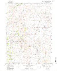
Other maps of this area

1939 · Big Piney
USGS Topo · 1:125,000

1942 · Big Piney
USGS Topo · 1:125,000

1955 · Preston
USGS Topo · 1:250,000

1958 · Preston
USGS Topo · 1:250,000

1962 · Preston
USGS Topo · 1:250,000

1969 · Chimney Butte
USGS Topo · 1:24,000

1969 · La Barge
USGS Topo · 1:24,000
1969 · The Hogsback
USGS Topo · 1:24,000
1969 · Pine Grove Ridge
USGS Topo · 1:24,000
1969 · Lake Mountain
USGS Topo · 1:24,000