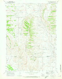
1969 Map of The Hogsback
USGS Topo · Published 1973About this map
The North La Barge Gas and Oil Field dominates this late-1960s landscape, illustrating the industrial footprint of energy extraction in western Wyoming. Spanning the boundary between Sublette and Lincoln counties, the map records a network of pipelines and gas wells integrated into the high-desert terrain. Industrial outposts like Calpet and Western Camp provided local centers for operations, while smaller settlements such as Viola and Dry Piney Camp mark the human presence in this sparsely populated region.
Find a feature on this map
42 named features on this map. Tap any name to fly to it.
Don’t see what you’re looking for? This feature index may not catch every label — zoom into the map to look around manually.
Map Details
Editions of this 1969 The Hogsback Map
2 editions found
Other maps of this area

1945 · Fort Hill
USGS Topo · 1:62,500

1947 · Fort Hill
USGS Topo · 1:62,500

1955 · Preston
USGS Topo · 1:250,000

1958 · Preston
USGS Topo · 1:250,000

1962 · Preston
USGS Topo · 1:250,000

1968 · Names Hill
USGS Topo · 1:24,000

1969 · Chimney Butte
USGS Topo · 1:24,000

1969 · La Barge
USGS Topo · 1:24,000

1969 · Cretaceous Mountain
USGS Topo · 1:24,000
1969 · Pine Grove Ridge
USGS Topo · 1:24,000