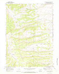
1969 Map of Pine Grove Ridge
USGS Topo · Published 1973About this map
Bridger National Forest dominates this Wyoming landscape, defined by a series of prominent high-altitude ridges running roughly northwest to southeast. The terrain transitions from Riley Ridge and Reed Trail Ridge in the north down toward the complex drainage systems of Pine Grove Creek and Fogarty Creek. Water management and resource exploration are evident through the presence of the Pine Grove Reservoir and numerous scattered drill holes throughout the peaks, indicating geological survey work or mineral prospecting during the late 1960s.
Find a feature on this map
24 named features on this map. Tap any name to fly to it.
Don’t see what you’re looking for? This feature index may not catch every label — zoom into the map to look around manually.
Map Details
Editions of this 1969 Pine Grove Ridge Map
2 editions found
Other maps of this area

1921 · Afton
USGS Topo · 1:125,000

1936 · Cokeville
USGS Topo · 1:96,000

1939 · Big Piney
USGS Topo · 1:125,000

1942 · Cokeville
USGS Topo · 1:125,000

1942 · Big Piney
USGS Topo · 1:125,000

1955 · Preston
USGS Topo · 1:250,000

1958 · Preston
USGS Topo · 1:250,000

1962 · Preston
USGS Topo · 1:250,000
1967 · Coal Creek
USGS Topo · 1:24,000

1967 · Mount Thompson
USGS Topo · 1:24,000