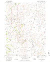
1969 Map of Cretaceous Mountain
USGS Topo · Published 1983About this map
Industrial development in the late 1960s defines this corner of Sublette County, where an extensive network of oil wells and gas wells dots the high-elevation landscape. The terrain is dominated by the massive ridge of Cretaceous Mountain and the expansive Big Mesa, which rise above a series of drainages including Fogarty Canyon Creek and Beaver Creek. A dedicated Pumping Sta and a network of pipelines illustrate the infrastructure required to transport resources from the surrounding oil field toward larger hubs.
Find a feature on this map
31 named features on this map. Tap any name to fly to it.
Don’t see what you’re looking for? This feature index may not catch every label — zoom into the map to look around manually.
Map Details
Editions of this 1969 Cretaceous Mountain Map
2 editions found
Other maps of this area

1939 · Big Piney
USGS Topo · 1:125,000

1942 · Big Piney
USGS Topo · 1:125,000

1955 · Preston
USGS Topo · 1:250,000

1958 · Preston
USGS Topo · 1:250,000

1962 · Preston
USGS Topo · 1:250,000

1969 · Chimney Butte
USGS Topo · 1:24,000

1969 · La Barge
USGS Topo · 1:24,000

1969 · Cretaceous Mountain
USGS Topo · 1:24,000
1969 · The Hogsback
USGS Topo · 1:24,000
1969 · Pine Grove Ridge
USGS Topo · 1:24,000