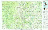
1991 Map of Big Rapids
USGS Topo · Published 1991About this map
The Muskegon River meanders through the heart of this West Michigan landscape, anchoring the regional hub of Big Rapids. This 1991 compilation captures a network of small timber and river towns connected by the C & O RR and major routes like Us 131. To the west, the Manistee National Forest covers a dense terrain of small lakes and creek systems, including Loda Lake and Wolf Lake, while the southern reaches are defined by the reservoir created by the Hardy Dam. Local transit and infrastructure are visible through facilities like the Baldwin Municipal Airport and the Forest Hill Cem in the county seat. This map documents a period of established recreation and forestry, showing the clear boundaries between the Pere Marquette State Forest and agricultural settlements like Remus and Barryton.
Find a feature on this map
53 named features on this map. Tap any name to fly to it.
Don’t see what you’re looking for? This feature index may not catch every label — zoom into the map to look around manually.
Map Details
Editions of this 1991 Big Rapids Map
This is the sole edition of this map. No revisions or reprints were ever made.
Other maps of this area

1916 · Mount Pleasant
USGS Topo · 1:62,500

1919 · Mount Pleasant
USGS Topo · 1:62,500

1931 · Baldwin NW
USGS Topo · 1:31,680

1931 · Custer NE
USGS Topo · 1:31,680

1931 · Chase NE
USGS Topo · 1:31,680

1931 · Walkerville NE
USGS Topo · 1:31,680

1931 · Baldwin NE
USGS Topo · 1:31,680

1931 · Custer SE
USGS Topo · 1:31,680

1931 · Walkerville SE
USGS Topo · 1:31,680

1932 · Freesoil SE
USGS Topo · 1:31,680