
1976 Map of Big Rapids SW
USGS Topo · Published 1979About this map
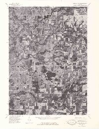
The Muskegon River flows through the northwest corner of this 1976 orthophotoquad, defining a landscape of agricultural fields and riverine wetlands in Mecosta County. The aerial perspective highlights the impounded waters of Rogers Dam Pond, where the river's path widens significantly. Moving south, the terrain is characterized by a patchwork of wooded parcels and farmsteads, intersected by Quacks Creek and eventually reaching the Little Muskegon River at the southern boundary. This map provides a clear view of the rural development patterns in the mid-1970s, as small crossroads settlements like Borland and Higbee Corner anchor the surrounding farm country. The village of Stanwood serves as a primary hub, situated where local roads meet the north-south transit corridor. For those researching local history, the sharp contrast between cultivated land and the winding river valleys reveals the topographical constraints on early Michigan settlement.
Find a feature on this map
7 named features on this map. Tap any name to fly to it.
Don’t see what you’re looking for? This feature index may not catch every label — zoom into the map to look around manually.
Map Details
Editions of this 1976 Big Rapids SW Map
This is the sole edition of this map. No revisions or reprints were ever made.
Other maps of this area

1954 · Midland
USGS Topo · 1:250,000

1958 · Midland
USGS Topo · 1:250,000

1958 · Sand Lake
USGS Topo · 1:62,500

1958 · Woodville
USGS Topo · 1:62,500

1958 · Big Rapids
USGS Topo · 1:62,500

1959 · Midland
USGS Topo · 1:250,000

1959 · Howard City
USGS Topo · 1:62,500

1966 · Midland
USGS Topo · 1:250,000

1976 · Big Rapids SE
USGS Topo · 1:24,000
1976 · Howard City NW
USGS Topo · 1:24,000